

📰 Curated from Ars Technica
📖 Read full article→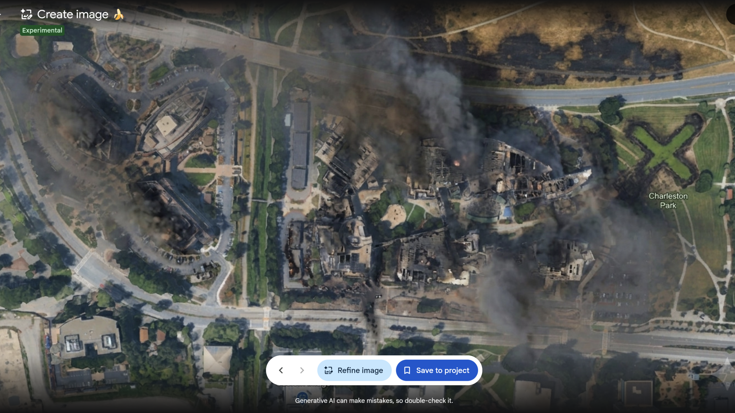
Google Earth releases, swiftly retracts AI feature to make fake satellite images - Ars Technica
Technology and ScienceBy Jeremy Hsu7/31/20261 min read
“What on earth is Google doing?” Misinformation fears spur walk-back of AI tool.
✨ Key Highlights
- Google Earth briefly rolled out an AI feature powered by its Nano Banana 2 image generator that let users create AI-modified versions of real satellite, aerial, and 3D imagery, then swiftly retracted it amid misinformation concerns, according to a July 31, 2026 Ars Technica report.
- Product manager Bryan Horowitz promoted the tool in a July 30 company blog post, touting that users could "for the first time" generate custom images grounded in Google Earth's real-world imagery.
- The feature alarmed researchers who rely on Google Earth to verify photos and videos of real locations, warning it made it far easier to fabricate false scenarios layered over authentic, photorealistic imagery.
- Bellingcat founder Eliot Higgins criticized the move on Bluesky, sarcastically noting the potential for abuse and sharing an AI-modified image depicting a giant golden statue of Donald Trump over the White House.
- Other examples circulated online, including a fabricated disaster scene at the Googleplex, Google and Alphabet's Mountain View, California headquarters, illustrating how convincingly authentic locations could be manipulated.
- Within a day of launch, Google announced on X that it was rolling back the feature, and Ars Technica confirmed it had become inaccessible to Google Earth users shortly afterward.